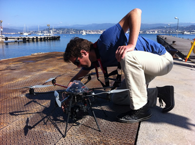
Aerial Photography
As part of its maritime structure expert projects, ACRI-IN uses a drone to
take aerial photographs.
Indispensable tool, with fast startup and silent operation,
it takes a series of detailed photographs to reconstruct an overall view of
the structure, which is then used for various applications: determining
damage after a major storm which has impacted a coastal site, monitoring
construction for a project manager, providing visual evidence for
communicating to customers, governments, operators, etc.
Designed for aerial photography, the
Mikrokopter/Hexakopter drone is a silent, clean, remarkably stable
flying platform, which can be moved from place to place extremely
precisely. The drone can carry an 18-55 mm digital camera (HD photos
and video). A remote video broadcasting system is used to control
framing and gives a real time view of the entire flight.


