Topographic surveys
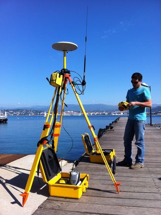
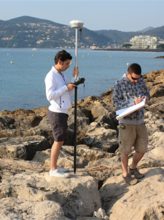
ACRI-IN owns a Trimble GPS that we use to perform
topographical surveys of a terrain. The data collected is used to
develop a map which graphically represents the elements surveyed
such as buildings, roads, vegetation, as well as variations in the
level of the land (altimetry). A 3D Digital Terrain Model (DTM) can
be generated from the data using software.
To get
precision down to the centimeter, we use real time "RTK" surveys: a
fixed GPS is placed in a reference (known x, y, and z coordinates)
or unreferenced location, which continuously records its position. A
mobile GPS connected by radio to the fixed GPS is used for the
topographical survey. This combination gives a precision down to 1
cm horizontally and 2 cm vertically.


